Eldergays, tell me about driving before GPS
...not just GPS, but Google Maps, Yahoo Maps and MapQuest. I'm in my late 30s. So, while smartphones weren't around when I started driving, MapQuest and Yahoo Maps were. So, technically, I've never driven unaided. I had today off work and had, literally, more than a dozen errands to run. I was driving all over the large city I live in and was able to plot out my destinations for a somewhat efficient day with Waze. It would be one thing if these were all regular stops, but most of them were places/businesses I'd never been to before. It easily could have taken twice as long had I had to consult a paper map. I know it sounds ridiculous to you, but I can't even imagine accomplishing all these tasks in an era before GPS.
I am, technically, barely, a millennial, so I guess you can grumble about those damn millennials now.
| by Anonymous | reply 104 | August 27, 2019 2:42 AM
|
With fewer entitled assholes such as yourself, traffic wasn't as congested.
| by Anonymous | reply 2 | August 21, 2019 4:49 AM
|
I am just old enough to have driven when all you had was a map in your car. It was a real pain in the ass if you were by yourself. What many people did was consult the map and write down the directions, then glanced at the directions while driving. If you got lost and had to consult the map again, you pulled over to the side of the road or into a parking lot and tried to find your way by looking at the map for the 100th time. Very time-consuming and frustrating. When Mapquest came along it made things easier, but thank god for GPS and Smartphones. That's what really made a tremendous difference.
| by Anonymous | reply 3 | August 21, 2019 4:53 AM
|
Those damn Millennials . . .
What? You just said we could.
| by Anonymous | reply 4 | August 21, 2019 4:54 AM
|
During the pre-Mapquest days, I drove the country from side to side and top to bottom with a Rand McNally atlas. If I was alone, I'd plan the trip in advance and write down the directions. If I was with friends and it was my turn to ride instead of drive, I enjoyed being the navigator and studying the maps.
| by Anonymous | reply 5 | August 21, 2019 5:02 AM
|
I learned how to drive just on the cusp of the early online mapping services; Mapquest was available by the time I was in college. So I learned how to drive and navigate just before all that hit.
People generally knew their area better and asked each other for directions a lot more. You'd learn the major traffic arteries where you grew up and in neighboring communities from traveling around with your family, and some would go more out of their way than others to teach their kids stuff like that. My grandparents use to have the grandkids help plot courses on maps for longer trips as we got older.
Generally, you'd only need directions off of the main arteries you knew, but yes, often you'd also have to use a map for new places. My family always made sure all the cars had an atlas in the trunk for emergencies. But I also remember plenty of people couldn't read maps well if at all, and they would either get directions from someone they knew or get them somewhere on the way.
| by Anonymous | reply 6 | August 21, 2019 5:07 AM
|
OP, a lot depended on your map reading and navigation skills, the quality of your maps and your sense of direction. Also, in the course of everyday life, it wasn't that common to go somewhere you were totally unfamiliar with. That is, you might not know how to find the exact spot, but already knew how to get to the general area. If you weren't 100% sure, a glance a map got you in the vicinity. If it was a small or obscure place, you usually asked directions before you went or else you got there and drove around until you found it. You used street addresses a lot.
Some people are just explorers by nature and enjoy finding their way. Others prefer step-by-step directions. In traveling long distances, I mapped out my route in advance but kept the map open on the seat next to me and glanced at it (as you might look at Waze on your phone) as needed.
| by Anonymous | reply 7 | August 21, 2019 5:08 AM
|
Worse was finding individual residences in a city one didn’t know. One had to use an atlas like OP posted for the city, use an index in the atlas to find a grid and locate the residence on a map of that grid location (such as B24 on page 32). From that grid map one would locate the major highway near the destination and chart a path using a map to get to that highway and from there use the directions to the residence.
| by Anonymous | reply 8 | August 21, 2019 5:08 AM
|
Piece of advice: avoid Albuquerque.
| by Anonymous | reply 9 | August 21, 2019 5:09 AM
|
I learned to drive before the Internet (yes). I learned to use those fold-up maps that you'd keep in the glove compartment. But then I bought a version of R5's atlas. Before I bought that, if I left the state, I'd need to stop at a gas station to get the appropriate local map for the state, although if you were well prepared, you could usually buy the appropriate map at a book store. I actually like reading maps. I do it for fun on-line (nerd).
| by Anonymous | reply 10 | August 21, 2019 5:14 AM
|
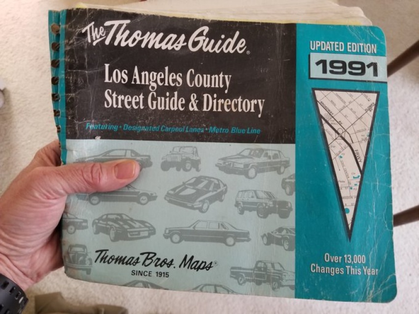
The Thomas Brothers Guide was always in the car. Using it required basic reading skills and common sense. It would never work today.
| by Anonymous | reply 11 | August 21, 2019 5:14 AM
|
R8, that would be a situation where you would usually get directions, wouldn't you?
Also, because there was no GPS, people learned how to find their way around. You learned the streets not only in your immediate area but anywhere you went more than once. You had to pay attention to where you were, to landmarks, street names and route numbers because you weren't just following step-by-step directions like an automaton.
To this day, I use Waze with the map function on screen rather than the list of turns. I want to SEE where I am on the map, not navigate on Instrument Flying Rules.
| by Anonymous | reply 12 | August 21, 2019 5:16 AM
|
As a 20-year-old, I never could have imagined the level of technological sophistication that exists today, and I take full advantage.
| by Anonymous | reply 13 | August 21, 2019 5:17 AM
|
Everyone had a Thomas Guide in their car in LA. Mine was well worn.
| by Anonymous | reply 14 | August 21, 2019 5:17 AM
|
[quote]I actually like reading maps. I do it for fun on-line (nerd).
Me too! I love maps and lament their passing.
I used to get my state maps from AAA. They were great when I first started driving (1970s). The quality deteriorated toward the end of the century, but at least they were free, and AAA had maps of everywhere. I always tried to get a detailed city map before I arrived anywhere or buy one as soon as I could after arrival.
| by Anonymous | reply 15 | August 21, 2019 5:20 AM
|
I can only imagine how difficult it must've been living in a city like Los Angeles before GPS. People must've got lost constantly.
| by Anonymous | reply 16 | August 21, 2019 5:25 AM
|
I'm only a year or two older than you are. I remember getting a Thomas Guide for Los Angeles. That was a life saver.
| by Anonymous | reply 17 | August 21, 2019 5:26 AM
|
I don't really need a GPS and I also wrote down directions and planned my trips before Google maps. But I was on vacation in Southeast Asia recently and I really don't know how I would survive a trip like this without Google maps now. I took a lot of local busses in Bangkok bc it was just really easy to look up bus lines on Google and then see on Maps when I had to get off - impossible without Google and saved a lot if money. I rented scooters on all the island and lots of streets are not even on a paper map so Google was just wonderful. Also really great to never get (or feel) lost in a big city or a remote area bc you always know where you are and don't have to ask locals (who often don't speak any English) for help or directions.
Same in Europe. I have visited London and other big cities before Google, but it is just so much easier. In London for example you type in your destination and Google tells you what bus or underground lines you can use and you also know exactly when to get off. All the bus stops even have letters so it is easy to find the right one immediately. Busses are so much more fun but also impossible to figure out without a smartphone.
| by Anonymous | reply 18 | August 21, 2019 5:29 AM
|
If you were going to a person's house you'd never been to before, they'd give you directions over the phone in advance, usually by landmarks. "Take a left off the exit ramp, then go through three traffic lights. Take a right at the Mobil station. In about a mile you'll see the sign for my street."
You'd write all this down over the phone and take it with you.
| by Anonymous | reply 19 | August 21, 2019 5:32 AM
|
And if the GPS dies? I imagine hundreds of cars stopped along the side of the road, their drivers bewildered, staring into space. Completely lost and helpless.
| by Anonymous | reply 20 | August 21, 2019 5:34 AM
|
[quote] that would be a situation where you would usually get directions, wouldn't you?
Not necessarily. Let’s say you were going from San Francisco to Los Angeles, if you knew which highway(s) connected the two cities and knew how to get to that highway from your residence you could make it to Los Angeles. It was once you were IN Los Angeles that the difficulty began. I’d buy (at a bookstore usually) a detailed street-by-street guide of the city I was going to and wrote directions to my specific destination. If I missed an exit I’d have to go back and find my way to the exit or consult the guide/map again. And those street maps often didn’t keep up with new construction, so if it was a new sub-division you had to ask for directions.
Fortunately those situations were in my very early driving years. Mapquest then came out, and I’d print the directions. I recall one time I got lost on a highway near Washington, DC or rather couldn’t find a way to get on the highway because construction had changed the traffic pattern and an on-ramp was closed. My mother and I were in the car. I was holding the Mapquest printed pages. I stopped to ask a cop for directions. He gave us directions, and he looked at the pages in my mom’s hand. He was rather young but still said something like “I’ll never trust Mapquest. Their directions have mistakes. Always have a map by your side.” I’m sure now he uses GPS and doesn’t even think of Mapquest or maps.
| by Anonymous | reply 21 | August 21, 2019 5:38 AM
|
I guess there would be a rush on gas stations to buy maps, r20.
| by Anonymous | reply 22 | August 21, 2019 5:38 AM
|
R22 IF the gas stations bothers to stock maps.
| by Anonymous | reply 23 | August 21, 2019 5:42 AM
|
I used to work as a nurse in San Diego County and I’d often travel to per diem jobs in Orange County a lot. I had a big Thomas Guide on the front passenger seat that I’d use religiously to find directions to hospitals that I hadn’t worked at before.
| by Anonymous | reply 24 | August 21, 2019 5:42 AM
|
R24, did you ever rub salt in wounds?
| by Anonymous | reply 25 | August 21, 2019 5:44 AM
|
(Trust me, it was a pain in the ass to scroll thru page after page trying to find a continuation of the route you were just looking at on the map)
| by Anonymous | reply 26 | August 21, 2019 5:44 AM
|
R25, every fucking chance I got.
| by Anonymous | reply 27 | August 21, 2019 5:45 AM
|
[Quote] And if the GPS dies? I imagine hundreds of cars stopped along the side of the road, their drivers bewildered, staring into space. Completely lost and helpless.
I still have a map in my car and I think a lot of people still do. Alamo always gave me a small map of the city and state when I rented a car. Not sure if they still do.
| by Anonymous | reply 28 | August 21, 2019 5:50 AM
|
I was a Realtor 20 years ago. Even with the advent of Mapquest, it would take a good amount of time plotting a route for a day of showings. GPS was a godsend.
| by Anonymous | reply 29 | August 21, 2019 5:55 AM
|
I just realized I have no idea if gas stations still sell maps, if they do I haven't noticed in a long, long time.
| by Anonymous | reply 30 | August 21, 2019 6:00 AM
|
Question for the GPS users - once you are instructed by GPS to an unfamiliar destination some distance away the first time, can you return there a few months later without the GPS? Are you building a mental map of where places are or are you always using GPS?
| by Anonymous | reply 31 | August 21, 2019 6:04 AM
|
r31 you've never used GPS?
| by Anonymous | reply 32 | August 21, 2019 6:06 AM
|
When I first started driving in 1968 I always kept a city street map and a state map in my glove compartment. As long as I had a city and state map and could find one street or road with a street sign, I could always find my way to where I wanted to go. Another thing that helped, especially when driving out in the country where it is all farmer's fields, is to look for distant landmarks, like railroad tracks, a huge barn silo, a water tower, etc. Aim your car for one of those things and keep driving until you get near it and eventually you'll find civilization again. When I first started driving I enjoyed just getting in the car (a little 1960 Rambler) in the morning and driving all day until after dark, never knowing where I might go. I might not have always known exactly where I was and I did get lost briefly occasionally but if I was lost I did what was mentioned in other posts: I pulled over to a quiet place, took out my many times folded gas station map and studied it, backtracking from where I am to where I want to go. It worked every time! As long as I could locate one street or road or highway sign, with my map index of street names and landmarks, I always found my way back home. It was an adventure.
| by Anonymous | reply 33 | August 21, 2019 6:08 AM
|
R21, I see what you mean. but when you said "residence," I assumed you meant someone's home. Wouldn't the person you were visiting have given you directions from the freeway?
| by Anonymous | reply 34 | August 21, 2019 6:40 AM
|
R31, Yes, I generally can. But I'm one of those people who can usually tell what direction I'm facing, even in a windowless room. Not 100%, of course. If I use my Garmin to get me to an unfamiliar part of town, I'm sort of unconsciously taken in the kinds of things I notice: trees, gardens, interesting architecture. That's why it's so much easier for me to navigate in the older parts of town, instead of the endless, lookalike suburbs and strip malls.
| by Anonymous | reply 35 | August 21, 2019 12:45 PM
|
OP, I'm 35 and remember what driving was like before GPS, Mapquest and the apps. Well, more like my parents and their Thomas Guide and AAA road maps. Mapquest didn't really take off until the early 2000s, no? I remember writing down directions when I had barely gotten my license.
| by Anonymous | reply 36 | August 21, 2019 1:55 PM
|
Road maps weren't always up to date. I remember driving around with my brother trying to find a local attraction we'd read about. It was on a residential street that stopped and started, so it was hard to get to the right block. The map did not match reality. At some point we gave up. These days a computer could direct me straight to it.
AAA used to provide TripTiks to member planning road trips. They also had good maps, but only for major metropolitan areas. I collected road maps for small towns in our vicinity because it could be impossible to find one's way around.
| by Anonymous | reply 37 | August 21, 2019 3:51 PM
|
I love maps and I love exploring. I need to see the big picture to orient myself and I have a good sense of direction. Blindly depending on a GPS unnerves me. Especially if you miss a turn and instead of just instructing you to turn around, it sends you off on a big long loop (country roads, not many crossroads).
| by Anonymous | reply 38 | August 21, 2019 4:03 PM
|
OP, you used to stop at service stations to ask directions. At least a decade, maybe two before GPS, that became useless, as full-service stations with long-term staff became fewer, or nonexistent even. Then I learned to stop at fire stations. They were the best because they were never busy and knew the roads and/or had maps. And sometimes the firemen were hot. Or, police stations and post offices. They were all good references. Sometimes, you’d have to stop at a phone booth to call for directions.
GOS must have paid for its satellites many times over in added productivity. And where did that wealth go? Hmm?
| by Anonymous | reply 39 | August 21, 2019 4:17 PM
|
I love maps but they were HELL to refold and, after awhile, they'd start to rip and get holes in them. Once you taped the holes, it was nearly impossible to refold.
There's an old wives tale that women drive by landmark and men drive by distance. For example, a woman might say, "turn left at the pink building" where men might say, "go 500 feet or a quarter mile." Which it interesting even now because your GPS will stills say, in 2 miles, turn left" I realize no GPS will say "turn right at the pink building." but still.
| by Anonymous | reply 40 | August 21, 2019 4:17 PM
|
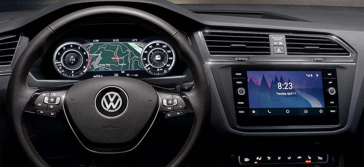
I'm an eldergay and was an early adopter of GPS, and nowadays I use Android Auto/Google Maps or Waze. But I still like to have a paper map or an atlas for looking at larger areas -- i.e., not a detailed street map like a Thomas Guide, but map of an entire state or metro area, just to give me some idea of what is where. Google Maps and the like are not good for things like that. They're also not great for trip planning. If I'm going to do a long road trip to an unfamiliar area, I'm gonna get paper maps and even a AAA TripTik.
| by Anonymous | reply 41 | August 21, 2019 10:14 PM
|
Before I had electronic maps I had a 1/2 dozen paper maps in my glove box now I don't have any paper maps in my car. I use my car nav most of the time but if I am in an area I've never been in I double check the nav with Google maps or Waze on my phone.
| by Anonymous | reply 42 | August 21, 2019 10:24 PM
|
Enjoyed reading your responses. Is anyone a weirdo like me and constantly keep Waze on -- even on your regular commute -- just so you can track cops? You can turn the audio of the directions off and just leave alerts on (cop ahead, traffic ahead etc). Waze has probably saved me from dozens of speeding tickets.
| by Anonymous | reply 43 | August 24, 2019 4:40 PM
|
OP, what an asinine enquiry.
Don't you still plan trips, even if you are consulting a map on the internet? Or does Siri ride shotgun?
We planned the trip ahead of time.
If we were visiting a relative, friend, or acquaintance, they gave us directions to their home or business.
Hotels or motels often gave directions to their visitors.
Sometimes travel agents planned trips for us.
We consulted maps. Gas stations at one time sold maps.
Bookstores did too.
We asked for directions, if we got lost...sometimes even from strangers!!! Imagine that, talking to someone you didn't know!
And OP, beware of Mapquest or others of its ilk...They'll give you the direct route. It might not be the most scenic or adventurous.
OP, I bet you never take a bath without a bath mat!!!
| by Anonymous | reply 44 | August 24, 2019 5:30 PM
|
We had Thomas Guides, OP. Before taking any trip outside our comfort zone, we consulted our guides and took notes, lest we make a wrong turn and end up in Compton, where we could get shot and killed by the armed natives.
| by Anonymous | reply 45 | August 24, 2019 5:48 PM
|
If you need directions to send food, you go past that camel shaped rock as you enter Darfur and make a left at the orphans burial grounds.
| by Anonymous | reply 46 | August 24, 2019 9:59 PM
|
We got lost a lot. Much harder to estimate driving time.
| by Anonymous | reply 47 | August 24, 2019 10:05 PM
|
I rarely use my navigation but my compass in the mirror is a lifesaver. I’ll never buy another car that doesn’t have a mirror compass
| by Anonymous | reply 48 | August 24, 2019 10:12 PM
|
r45's post reminded me - in the days before smartphones and GPS a friend and I got lost in Newark NJ at 11:00 at night. We drove around for an hour before we found our way out of there. I've been in some shit neighborhoods and it never really bothered me, but that night in Newark I was truly frightened.
| by Anonymous | reply 49 | August 24, 2019 10:15 PM
|
My Dad always had a boat compass in the car. Silly, though, as roads wind around in all directions in the short term.
Near Boston, I-93 South and Rt. 128 North are the same roadway for a length of road, IIRC.
| by Anonymous | reply 50 | August 24, 2019 10:18 PM
|
Years ago we went to CT and stayed at a bed & breakfast. We were going somewhere for dinner. I had looked up the restaurant on my computer before I left home and had printed out the route/directions from the B&B to the restaurant. It took about half an hour to get to the restaurant and we had to get in and off a huge highway. After dinner we turned out of the parking lot onto a one way road. I got out the printed directions and was reading them, planning to turn around the next time we had the opportunity when we came to a fork in the road. “Go that way” I said. 2 minutes later we saw the bed & breakfast. It was 2 minutes away from the restaurant but the computer directions did this huge, complicated thing because it didn’t recognize a two-road fork .
| by Anonymous | reply 51 | August 24, 2019 10:24 PM
|
What you may not realize, OP, is that many of us who are pre-GPS drivers have a great sense of direction. We know places in a way you never will. There are a number of senses and analytical skills you accrue as you use maps to find your way. Like knowing which way is North, knowing the fastest way to get somewhere without Siri telling you because you have a sense of the diagonal between two places. Or a parallel route. It's hard to explain, but I notice it with my much younger husband. Terrible sense of direction. Hasn't a clue where things are on the planet earth. Have I been lost? Yes, and sometimes it was wonderful. Did I always find my way. Yep.
| by Anonymous | reply 52 | August 24, 2019 11:19 PM
|
R43/OP: Yes, I leave my Waze on during my regular commute. This serves two purposes: (1) I commute on an expressway that often backs up; by refreshing the route, I sometimes find that Waze has found a faster alternative route. (2) It's nice know when I'll arrive. This is sort of an addictive feature, and, to my own annoyance, I find myself opening Waze even for very familiar trips on roads that rarely back up.
[quote] And OP, beware of Mapquest or others of its ilk...They'll give you the direct route. It might not be the most scenic or adventurous.
This is why I use paper maps when I travel or am planning even a day trip. Sometimes, I want to take the pretty route or see something I haven't seen before.
And I do notice that, with Waze, I less often turn down a side street or take an unfamiliar road just for the hell of it.
I see all the advantages of GPS that others have discussed here, but I do think it's turning us into a nation of automatons behind the wheel.
| by Anonymous | reply 53 | August 24, 2019 11:52 PM
|
I don’t want navigation in my next car. I have it in my present car because it came with the premium package. I never use it, it’s a waste of money.
| by Anonymous | reply 54 | August 25, 2019 12:44 AM
|
One of the worst situations was business travel. When you rented a car, they gave you a small map that didn't have much detail except all the highways.
I recall flying in late at night and driving in the dark, not knowing the city, looking at a stupid rental car map and trying to navigate to your destination. It was awful.
Navigation has to be one of the best products of the internet.
| by Anonymous | reply 55 | August 25, 2019 12:52 AM
|
I just use my phone’s map app. It works better than my navigation. Plus, my navigation doesnt show traffic. Probably newer navigation systems do, but why pay $2-3k for it when I have it for free.
| by Anonymous | reply 56 | August 25, 2019 1:05 AM
|
There are still a LOT of places that don't have cell phone or wi-fi access on the road -- so it's nice to have the in-car navigation as a backup for that situation.
| by Anonymous | reply 57 | August 25, 2019 1:33 AM
|
I had an Atlas road map in my car OP. Worked just fine. WAZE etc are very nice but, we managed with naps just fine. But you know OP, your question, if not a set up is why a lot of people think those younger than 35 are imbeciles.
| by Anonymous | reply 58 | August 25, 2019 3:16 AM
|
Around 1982, I had a map that confused me. It showed no Newport bridge. Eventually I figured out that my map was from 1968, and they had built a bridge in Newport after that, so I threw the damn map out.
| by Anonymous | reply 59 | August 25, 2019 4:10 AM
|
Maps were a pain in the ass, I don't miss them at all. Especially at night, as the above poster mentioned. GPS was one of the greatest inventions. I haven't used a map in years.
| by Anonymous | reply 60 | August 25, 2019 7:31 AM
|
[quote] WAZE etc are very nice but, we managed with naps just fine.
Yes, indeed. I once napped all the way down the New Jersey Turnpike. I drifted off somewhere around the Meadowlands and didn't wake up until I had crossed the bridge into Delaware. Unfortunately, my intended destination was Philadelphia, but I felt very well rested. (Sorry, R58. I couldn't resist.)
| by Anonymous | reply 61 | August 25, 2019 7:59 AM
|
Maps are essential for exploring and for drivers who like a big-picture sense of where they are (usually not necessary on familiar roads). If all you want to do is get from one place to another as fast as possible, GPS is a godsend.
There's room for both, but getting good maps is hard these days.
| by Anonymous | reply 62 | August 25, 2019 8:04 AM
|
AAA TripTik's were the BEST! You'd go to AAA and tell them where you were starting and ending and they would put a booklet together of maps, each page with a different segment of the map. So if you were planning to drive from NYC to Virginia Beach, they would give you the NYC map, the NJ Turnpike page, the Delaware page, the Maryland/DC/Virginia highway page, etc... then they would highlight the route. The last page was always local map of the destination city. Especially good if you had a passenger to keep an eye on the maps as you were driving.
| by Anonymous | reply 63 | August 25, 2019 11:57 AM
|
In Dallas, you had a MAPSCO, which is similar to a Thomas guide (I lived in LA too). In DC, you had an ADC. You never got into the car without your guide. If you took a road trip, you mapped out your route, and wrote down the directions.
| by Anonymous | reply 64 | August 25, 2019 12:13 PM
|
It would be difficult to overstate the importance of being able to read a map and navigage from it. There is the practical matter of being able to move around freely and confidently, but then there is the more important matter of self-reliance and the self-confidence that flows from it. And independence. Independence from insidious corporate influence.
I watch younger friends now who only know how to follow commands issued by their GPS and am grateful not to be so dependent on Google. The map reading is important. Then there is the further skill of incorporating the knowledge gleaned from the map and employing it in real time as you move about.
A few years ago, I moved to a new city. The GPS made it much easier to get started there. I didn't need instructions on one discreet trip, I needed a guide for all of them. As grateful as I was for this assistance, if I repeated a trip to a destination, I tried it from memory. Being an ignorant recepticle for a phone is not for me. What is given up in that transformation is far too important.
| by Anonymous | reply 65 | August 25, 2019 12:44 PM
|
It was more difficult to get a job at a gas station. You had to know your streets.
| by Anonymous | reply 66 | August 25, 2019 2:03 PM
|
Rand-McNally had a store in NY I would go there to buy maps for my car, they had the best maps. Now I use the nav in my car as some have said, cell phone service is not available everywhere. I have friends in upstate NY and cell service is spotty satellite service which is what car nav uses is not.
| by Anonymous | reply 67 | August 25, 2019 2:58 PM
|
In some very rural areas, the car GPS will not work either.
| by Anonymous | reply 68 | August 25, 2019 3:00 PM
|
r68 Why would the GPS not work? It works for hikers in remote mountainous areas.
| by Anonymous | reply 69 | August 25, 2019 5:47 PM
|
AAA still has a huge selection of paper maps. I went there recently because I was going to be exploring (by car) a new area and they even had street maps of some the smaller towns (which I didn't really need.) But they have lots of specialty maps dealing with tourist areas and common travel destinations. (And free if you're a member, of course.) And you can even download and print them!
| by Anonymous | reply 70 | August 25, 2019 5:50 PM
|
R69
It did not work last summer in parts of remote Maine
| by Anonymous | reply 71 | August 25, 2019 5:51 PM
|
I would enjoy these threads so much more if they didn’t begin with “eldergays “
| by Anonymous | reply 75 | August 25, 2019 5:58 PM
|
Depending on your life, you may not drive that much aside from your regular routes. If you were going somewhere new, you asked your host how to get there on the phone beforehand. ("Two blocks later there's a Texaco station and you take a right.") You would put who ever was better with directions on the phone for this step.
If you got lost, you asked for directions at the next gas station, and backtracked. Either an employee or a customer would tell you.
My single mom would never have troubled with a map. But then, we didn't suddenly drive off into the horizon at the drop of a hat, either. And everyone in my family's pretty good looking. An advantage that comes with that is people generally help you when you ask them.
Note: You also left the house a bit earlier if going somewhere new, because invariably you wouldn't be able to find it right away the first time.
| by Anonymous | reply 76 | August 25, 2019 6:09 PM
|
It was cold OP, and dark. We were alone on winding, empty roadways. The growing sense of fear in the near-impenetrable darkness was broken only by weak glow of our non-adaptive headlights. There were no “street lamps” outside of cities because there weren’t enough lamplighters out in the sparsely populated countryside. There were wild animals lurking in woods and fields. If your car broke down, the chances of being found were slim. Should you get out of your car and try to walk to a homestead and ask for help? You chanced being attacked by wolf packs or cave bears. And what might you find at that homestead? Perhaps a family that had been so long isolated that they’d reverted to primitive practices like incest, leaving the current tenants feeble minded, addled and violent towards outsiders.....
| by Anonymous | reply 77 | August 25, 2019 6:21 PM
|
I used Lesbians as my GPS! They have an amazing sense of direction.
| by Anonymous | reply 78 | August 25, 2019 6:27 PM
|
GPS works everywhere in the world, as long as it can see 3 of the 24 satellites (i.e. they’re not blocked by very tall mountains as in a deep canyon or something), so your device always knows its coordinates. But map apps need a cell signal to continuously download the current map image as you drive along. So it can seem like GPS is not working in remote locations, but what’s happening is your device simply has no map on which to display your location. I believe you can preload the map images for your route onto your device before you go to avoid this happening.
| by Anonymous | reply 79 | August 25, 2019 6:43 PM
|
You can't drive across tiny Vermont without losing your cell signal. Download the map for your route before you hit the road.
| by Anonymous | reply 80 | August 25, 2019 6:56 PM
|
[quote]I believe you can preload the map images for your route onto your device before you go to avoid this happening.
As if the Eldersisters here would know what you're talking about. They're still using flip phones.
| by Anonymous | reply 81 | August 25, 2019 7:08 PM
|
R81, all the technology you claim to have mastered... we invented it. The internet, too. Also wireless communication and recorded sound.
| by Anonymous | reply 82 | August 25, 2019 7:13 PM
|
I remember being lost late at night, no clue where the hell I was, so I parked at a residential street, looked at the street sign, and looked up that street in the Thomas Guide index. It said something like the street is on page 732, on grid A2.
I was fond of the Thomas Guide and feel it made you appreciate where you live and all its details more than Google Maps does. In fact it took this thread for me to face facts that the Thomas Guide is a thing of the past.
Also, gas station staff had a reputation about being really good about where everything was and how to get there.
| by Anonymous | reply 83 | August 25, 2019 7:19 PM
|
[quote]all the technology you claim to have mastered... we invented it.
A FEW of you helped to invent it, along with Gen Xers. The rest of you bitch and moan endlessly about it.
| by Anonymous | reply 84 | August 25, 2019 8:40 PM
|
Did gas station staff used to be Americans back in the day? Where I'm from, they're newly arrived immigrants who can barely speak English. Forget about asking for directions.
| by Anonymous | reply 85 | August 25, 2019 8:41 PM
|
[quote]all the technology you claim to have mastered... we invented it.
But you haven't kept up, and it's frustrating for others. Especially in the workplace, but that's a whole other thread.
| by Anonymous | reply 86 | August 25, 2019 8:49 PM
|
R84, you forgot to add that only a FEW eldergays still use flip phones.
| by Anonymous | reply 87 | August 25, 2019 8:50 PM
|
You went to AAA and some lady invariably named Nancy with horn-rimmed glasses or a guy called Bob in a short-sleeved pinstripe shirt broke out a map and a highlighter....
| by Anonymous | reply 88 | August 25, 2019 8:52 PM
|
There used to be a lot of crime. A friend and I got lost driving back to manhattan from Long Island one night. We stopped at a gas station to ask directions because we were scared, but the guy was Turkish and he literally didn’t even know where he was. That was the first time we stopped at a gas station that didn't have American employees. The reason why we were scared was that there were lots of carjackings and a robbery had taken place at a diner on Long Island where 6 men forced dozens of customers and staff to have sex with each other for hours.
Things were bad back in the day before cellphones
| by Anonymous | reply 89 | August 25, 2019 9:12 PM
|
I was just looking at correspondence we had before travelling to Mijas; were staying at a guest house out past the main town in an extremely mountainous area that had been recommended by a very good friend at the firm I was working at. After 24 hours of travel from LAX, we collected our car in Malaga and drove after dark to the guest house. Our host recommended that we back down the tiny hillside dirt road for the last little bit because it was difficult to turn around. Exhausted, we slept like the dead but were rewarded the next morning with a gorgeous view of the Med through an olive orchard on the hillside where our guest house was located. In daylight, it was obvious how precarious the little road was, but we had no major problems during our stay. I was amazed by the little hand-written map our host had made for us, and how we ended up at our destination perfectly. (And yes, it was a manual transmission!)
The main difference for me is that one had to actively participate in travel, first, by knowing geography of the destination, and then studying paper maps/guides prior, and then during the trip. It's such a passive experience to depend on the NAV to get somewhere . . . I am blessed with a superb sense of direction, but admit that using a NAV is so effortless . . . apart from road trips (fortunate to have done lots, foreign & domestic) I love ocean travel, and can usually tell where we are at sea--it's a wonderful experience to have the route mentally set, and then watch it unfold day by day. I'm ready right now for another journey, and yes, getting there is half the fun . . .
| by Anonymous | reply 90 | August 25, 2019 10:37 PM
|
[quote]But map apps need a cell signal to continuously download the current map image as you drive along. So it can seem like GPS is not working in remote locations, but what’s happening is your device simply has no map on which to display your location.
r79 That doesn't apply to car GPS systems. They have the maps already downloaded and do not need a cell signal -- they just use the GPS satellites for navigation. So unless one of the problems you mentioned about satellite blockage exists, the in-car GPS should work just about anywhere, as long as you have the appropriate maps installed. Most cars sold in the US have the US and Canada; most people aren't likely to be driving anywhere else in their own cars.
| by Anonymous | reply 91 | August 26, 2019 1:30 AM
|
[quote]I used Lesbians as my GPS! They have an amazing sense of direction.
So you just follow the nearest Subaru?
| by Anonymous | reply 92 | August 26, 2019 1:32 AM
|
R85: Yes, in most of the US, they were native-born Americans. Also, because nearly all gas stations were also service stations, they could do minor repairs on the spot.
| by Anonymous | reply 93 | August 26, 2019 6:16 AM
|
R77, I see you've been driving in rural Pennsylvania recently.
| by Anonymous | reply 94 | August 26, 2019 6:17 AM
|
It can be a bad idea to just rely on GPS. I used by TomTom for a business trip in Hawai'i. I had the hotel's address from their website and entered it into the GPS. The directions were incorrect. When I called the hotel, I was told that I was in a VERY BAD section of the island. The woman told me to keep my phone and on and talk to her every few minutes to tell her what I was seeing. She said she wouldn't hang up until I pulled into the parking lot. She asked for the make and model of my car as well. When I pulled in, it was just getting dark and the woman from the phone was standing outside. She actually gave me a hug! She said HI had (at the time it was 2007-8) a really bad meth problem and I could have gotten killed.
Another cautionary tale with GPS. I lost my signal by taking the lower level on the George Washington Bridge. I normally take the upper level but followed the instructions given. I got off somewhere around Amsterdam Ave in the Bronx. Two problems; (1) tall buildings and (2) overcast skies prevented the GPS from picking up a signal quickly. GPS kept telling me to make a left, recalculating, make a left, recalculating, etc. I finally found the name of a street I knew and found my way out of there.
| by Anonymous | reply 95 | August 26, 2019 1:23 PM
|
R95
I totally agree. Technology can fail.
| by Anonymous | reply 96 | August 26, 2019 2:02 PM
|
[quote]I know it sounds ridiculous to you, but I can't even imagine accomplishing all these tasks in an era before GPS.
Not ridiculous, helpless. You sound sadly helpless and ineffectual from not only being unable to accomplish basic tasks unaided, but by also being so flummoxed by the ability of others to do so.
I'm not suggesting the other extreme of DL luddites taking pride in being ignorant of technology either. It's the inability to figure things out and helplessness in the face of simple tasks that's the criticism.
| by Anonymous | reply 97 | August 26, 2019 2:22 PM
|
It could be a bitch at times, but it was doable.
| by Anonymous | reply 98 | August 26, 2019 2:40 PM
|
OP, you know when you're driving on the highway and there are all those big expensive green signs that name various popular destinations, the mileage to them, and then feature arrows that tell you which way to go and which exit to take? Those are used for navigation.
| by Anonymous | reply 99 | August 26, 2019 2:52 PM
|
I agree R95 GPS and your car nav can be wrong which is why I use one to checkup on the other. Recently I went to dinner with friends in an area of Brooklyn I have never been to and my phone GPS told me to go one way and my car nave gave different directions both got to the same location but I used the directions that appeared to be the easier route.
| by Anonymous | reply 100 | August 26, 2019 8:17 PM
|
I learned to drive in 1984 in the suburbs of NYC. I pretty much knew the area in a ten mile radius. I might not know where a particular street was, but I would know something near it. We didn’t have cell phones either, so if you got lost you couldn’t call someone that easily. So people got lost, but it wouldn’t take that long before you’d see something familiar and get your bearings. For longer trips, maps.
If you were going someplace unfamiliar and it was important, you would either allow a lot of extra time, or do a practice run.
I’ve driven in Europe within the last ten years using maps, not GPS. More than once, but I can’t remember why I didn’t have a GPS. Maybe rental places were all out? It’s not that big a deal for me, BUT travel planning is something I enjoy, so I do study maps before a trip to someplace new. That helps with pubic transport too, I just have a better sense of where I am relative to landmarks of interest to me (transportation hubs, hotels, tourist sites, etc.).
| by Anonymous | reply 101 | August 26, 2019 9:11 PM
|
In my day, the terrifying thing about stopping at a gas station for directions was the burly, grease-smeared mechanics would sometimes try to "interfere" with you!
Often they wouldn't give directions without some type of ... arrangement. And invariably your clothes would be RUINED!
| by Anonymous | reply 102 | August 26, 2019 9:27 PM
|
I fucking love you, R77 and R78. And, aw, R75, I can't speak for others here, but "Eldergays" is absolutely a term of endearment for me. And, at 38, I'm practically one myself anyway.
I'm still enjoying reading your responses. Even the mean ones.
| by Anonymous | reply 103 | August 27, 2019 2:05 AM
|
38? Oh, sonny. Not for a long, long time.
| by Anonymous | reply 104 | August 27, 2019 2:42 AM
|